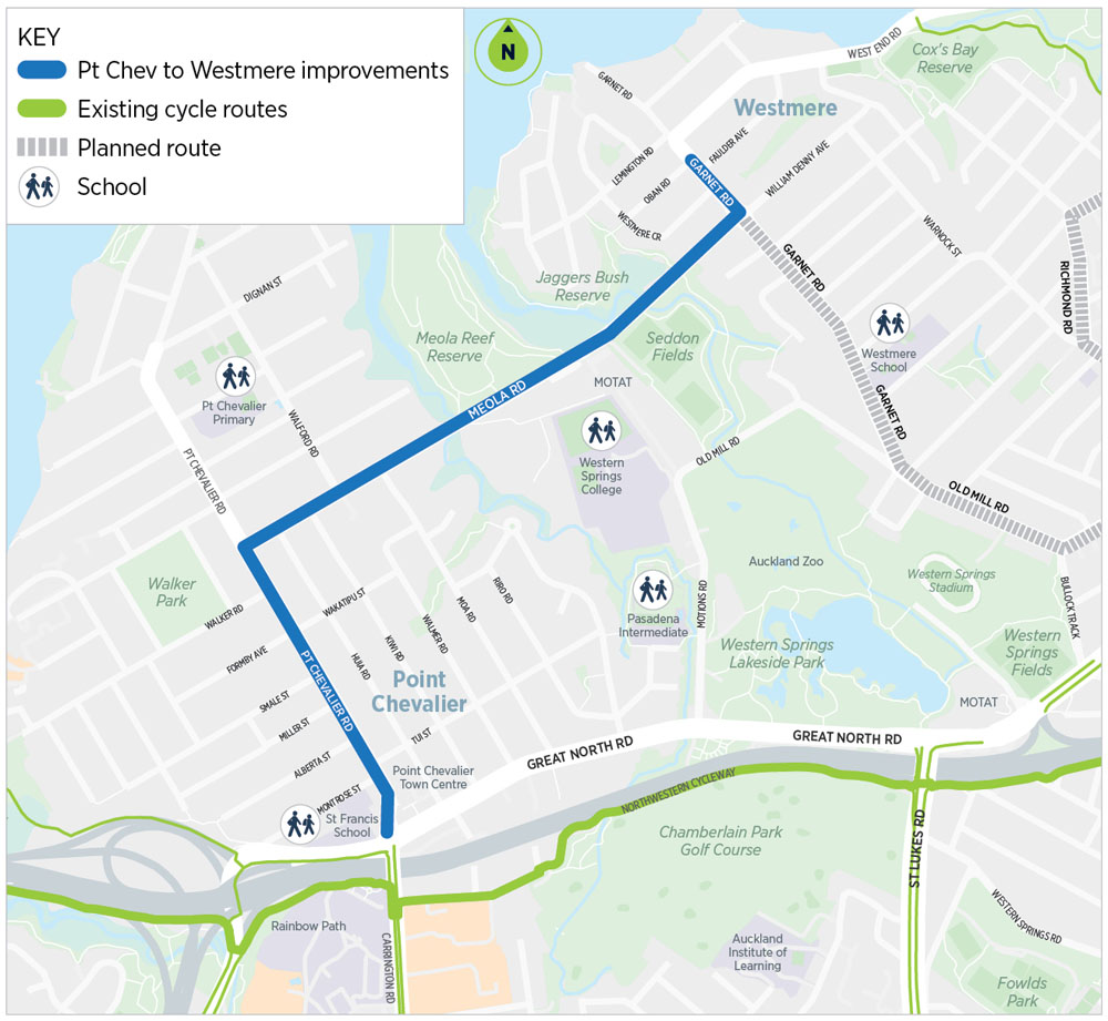
Point Chevalier to Westmere improvements (incl. Meola Road)
We're improving safety and accessibility for people walking, riding and using a bus between Point Chevalier town centre and the Westmere shops.
On this page
Meola Road
Meola Road is closed between Walford and Huia Road from 29 April to August 2024.
So far we have:
- rebuilt the road from the foundations to raise it above the floodplain
- undergrounded the power lines
- built new driveways for Seddon Fields and MOTAT
- upgraded stormwater pipes.

There are stop-go closures in place on Monday to Saturday between 7am and 7pm. All other times, the road will be open except the area between Walford and Huia Road. On road parking is not available.
Access to driveways for local residents will be maintained as best as possible. If residents have access needs please contact us.
Contact Dempsey Wood
Contact AT
Point Chevalier Road
There are multiple worksites between Meola Road and Tui Street. Northbound traffic (heading towards the beach) will need to follow the detours in place.
Garnet Road
Works will begin on Garnet Road from Monday 6 May 2024.
Initial work will be just south of the roundabout to the intersection of Westmere Crescent. Stop-go signs will be in place.
Stay up to date
To sign up for a monthly update, email: projects@at.govt.nz. Please include "PTC2W sign up" in the subject line of your email.
About the project
We’re working to make Point Chevalier Road, Meola Road, and Garnet Road safer and more accessible. The project is under construction and will be completed in mid-2025.
The project will:
- add more pedestrian crossings
- improve cycling safety
- improve existing bus stops and add new shelters
- add more trees and landscaping
- redesign streets to encourage slower vehicle speeds
- add seating and rubbish bins
- provide a great environment for outdoor dining
- improve storm water and drainage
- rebuild Meola Road's foundations
- move Meola Road powerlines underground.
Stormwater
We're delivering the stormwater network installation on Point Chevalier Road for Healthy Waters, saving money and time by sharing contractors, equipment and utilising the same traffic management plan and only digging up the road once.
The new stormwater network planned for Point Chevalier is part of a larger project in Auckland to separate combined networks, where stormwater discharges into the wastewater network. Separating the stormwater from the combined network reduces overflows in wet weather.
The stormwater infrastructure for Point Chevalier Road will include the installation of around 900 metres of pipe and associated stormwater manholes.
Timeline
- 2016 – community consultation on cycle routes between Point Chevalier and the city fringe
- 2017 – community consultation on a concept design for a cycleway between Point Chevalier and Westmere
- 2017 to 2018 – reviewed design based on community feedback
- 2019 – community consultation on a revised design
- 2020 to 2021 – project delay due to 2020 Covid-19 emergency budget
- early 2022 – re-engaged with the community
- late 2022 – political re-engagement
- late 2023 – construction begins
- mid-2025 – construction complete.