Glen Innes to Tāmaki Drive Shared Path Glen Innes to Tāmaki Drive Shared Path
Te Ara Ki Uta Ki Tai – the path of land to sea – is a 7km long shared path from Merton Road near Glen Innes Station to Tāmaki Drive. It allows you to walk, run or cycle from Auckland’s eastern suburbs to the Waitematā Harbour. The path will be built in 4 stages.
Project status
- Section 4 – construction from April 2025 to the end of 2026
- Section 1 – completed, 2016
- Section 2 – completed, May 2022
- Section 3 – completed, July 2019
Latest news
Section 3
Our investigations are complete, and we are now assessing options to address the pile deterioration on the Orakei Basin Boardwalk. This includes costs, constructability, longevity and environmental considerations.
We expect to have identified the best way forward to address the pile deterioration by October 2025.
The boardwalk will remain open and be regularly monitored. We appreciate everyone’s patience. Please take care through this section – we ask cyclists and scooter riders to please dismount at busy times.
Section 4
We've started work on the 870-metre concrete boardwalk in Hobson Bay. We expect it to open by the end of 2026. This is the final section and will complete this project.
Construction update - July 2025 (PDF, 2MB)
Where the work is happening
The 3 main work areas are:
- Whakatakataka Reserve, Ngapipi Road
- the rear of Ōrākei Train Station Park n Ride
- next to Purewa Bridge, Ōrākei Road.
Construction impacts
The main impacts will be from:
- temporary traffic management beside Purewa Bridge on Ōrākei Road
- construction vehicle movements to and from Whakatakataka Reserve and Ōrākei Train Station.
Our work is carefully planned to minimise disruption on these busy commuter routes. Our temporary traffic management will include:
- stop and go, or traffic lights when large machinery or plant is entering or exiting the worksites
- lane reduction and shoulder closures when working next to Purewa
- bridge, maintaining two-way traffic flow
- a lower posted speed limit past work areas for everyone’s safety.
Disruptions
There may be some noise or vibration felt from construction. We will have control measures on-site and will monitor this closely.
Our site compound in Ōrākei Station will impact the number of available car parks, but train services will run as normal.
Learn more
For more information, download:
April 2025 – Ōrākei Basin boardwalk update
We’re inspecting boardwalk piles. This affects a 230-metre section on the rail side of the boardwalk. The piles here are about 20 years old and may need replacing.
We'll do the inspections when the basin is empty (flushed) and the piles are exposed. This could take several weeks. We can then identify what action is needed.
The boardwalk width will be narrowed. Take care through this section. Cyclists and scooter riders should dismount.
Contact us
We'll host drop-in sessions for locals to speak to the project team, and learn more about the design and construction of the path.
If you have any queries or concerns about this project, contact AT by:
- email: projects@at.govt.nz
- phone: 09 930 5090.
Section 4 (Ōrākei Basin to Tāmaki Drive) - the last link
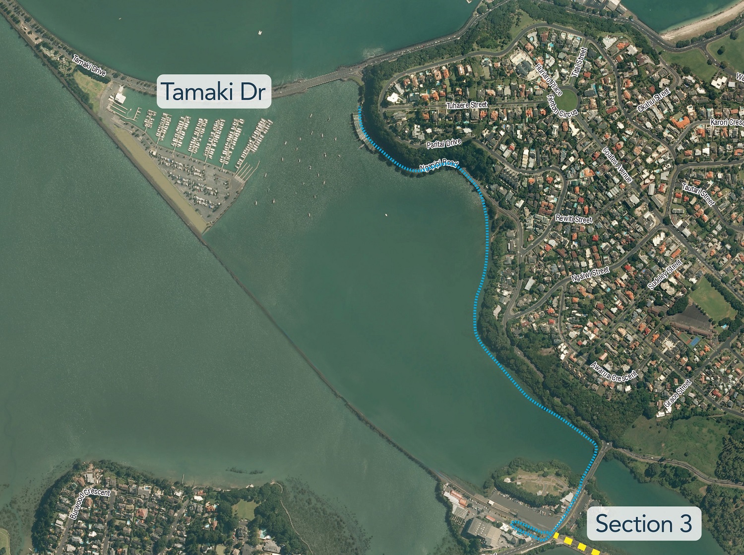
The final stage to complete section 4 is the 870m bridge and boardwalk in Hobson Bay, connecting from Orakei Road to Whakatakataka Reserve.
In the meantime, pedestrians and cyclists reach Tāmaki Drive using Ngapipi Road, which features a temporary uni-directional cycleway.
This is a priority project for AT as a key piece of the wider Strategic Cycling Network, providing healthier car-free choices for how people choose to travel around their neighbourhood and for their commute.
Other works completed on Section 4
Shared paths connecting Ōrākei Basin Boardwalk to and along Ngapipi Road from Whakatakataka Reserve past the boatsheds to Tāmaki Drive are complete.
A community asset, connecting with nature
We received overwhelmingly positive feedback about the design for the boardwalk, which follows the Hobson Bay coastline. Distanced from rail and traffic noise, it will provide a respite in people’s daily commute, and attract more people to opt for healthy, congestion free ways to travel. With its stunning surrounds it will also be a popular destination for Aucklanders.
Read the feedback summary report.
Designed with the community in mind
Community feedback received through this consultation and other sections of the path – including the Ōrākei Basin Boardwalk - has highlighted the importance of a low (1.2m) and more permeable (or ‘see through’) balustrade, so people can take in views of the surrounding environment. We received very positive feedback about the design, including about it being sympathetic and fitting with the environment.
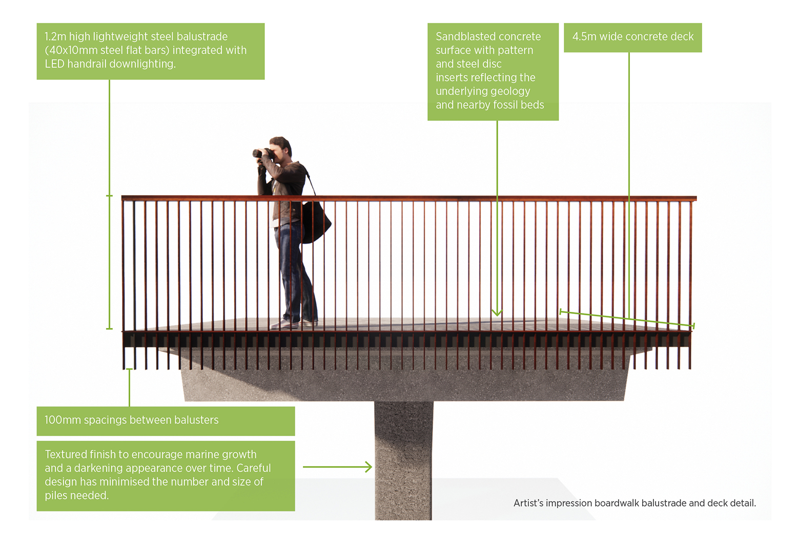
We were asked during the consultation to show how the balustrade permeability compares with the Section 3 balustrade, so we produced a pack giving more detail about the design.
We also worked closely with our Mana Whenua project partners and key stakeholders including Ōrākei Local Board and Bike Auckland. Through our work with these stakeholders, we ensured the design:
- retains recreational water access
- complements Ōrākei Local Board and Auckland Council aspirations to restore Whakatakataka Reserve
- provides access for boatshed owners and safety for path shed users
- considers sea-level rise
- minimises the size of the boardwalk and bridge, and complements the natural environment.
We have also reflected feedback received from consultations on other sections of the path. We know it is important to the community that:
- lighting is unobtrusive, while still illuminating the path safety
- we preserve views from the path
- people are kept safe with surfaces that minimise the risk of slipping
- the balustrade height is kept low, while still being safe
- curves are smooth for cyclists
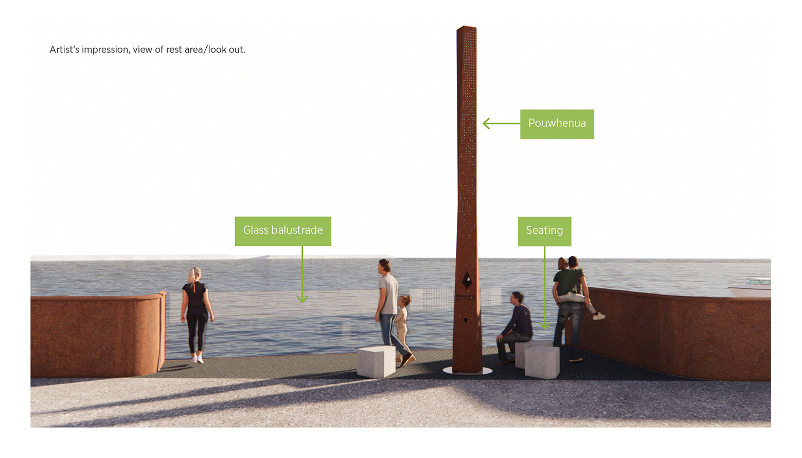
- a rest area is provided.
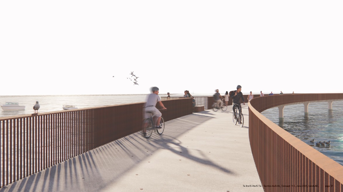
Bird's eye view of Section 4
Unless you get out in the bay to paddleboard or kayak, you probably won’t have seen the beautiful coastline up-close. Take a moment to watch our video to get a glimpse of what it will be like to travel along this path.
Ngā mahi toi – recognising Mana Whenua values
Cultural markers (pou) will be positioned in significant locations to tell important Mana Whenua narratives of this place. Developed in collaboration with Mana Whenua and artist Graham Tipene, they will provide wayfinding and cultural interpretation points along the pathway. The pou will include integrated carved creative expressions with backlighting and interpretive information.
Boardwalk lighting and materials
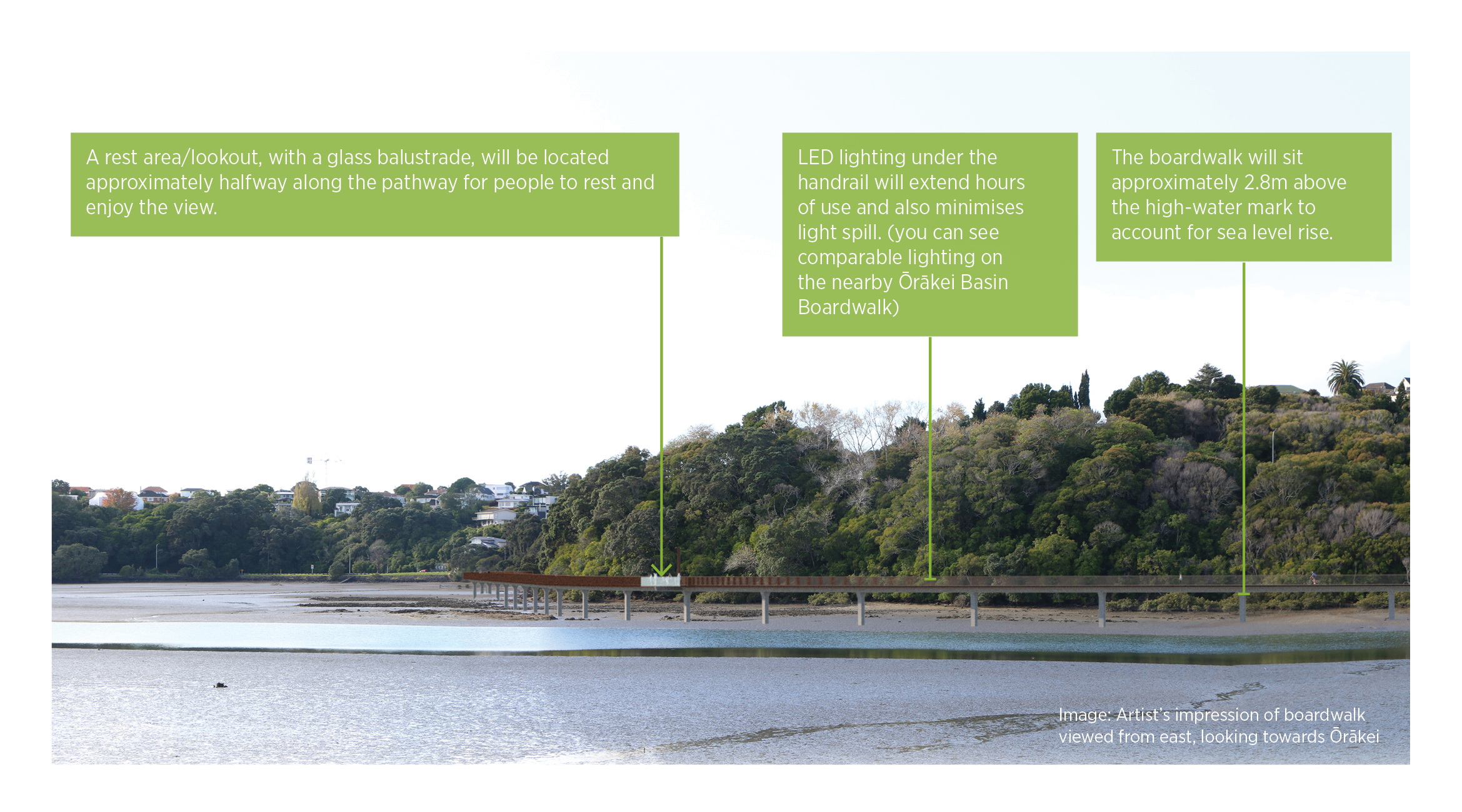
The bridge and boardwalk will comprise a concrete deck and timber and steel balustrades with LED downlighting in the handrail.
To determine the alignment of the boardwalk in Hobson Bay, we have considered user comfort, the potential impact on neighbours, marine traffic, water access and use, environmental impact and sea-level rise.
Subtle materials, finishes and design details have been selected to naturally complement the coastal landscape and its curved form.
Interim improvements on Ngapipi Road
With many more people travelling through the area, the interim facility on Ngapipi Road is much needed until the boardwalk in Hobson Bay is constructed, creating an alternative route. The 4.5m wide boardwalk will have smooth surfacing and low gradients making it a faster, more comfortable, and accessible route to take to and from Tāmaki Drive.
Ngapipi Road is a challenging location due to its topography, high traffic volumes, importance as a freight and bus route and lack of available space for new facilities. Space allows for a one-way cycle facility only, and the footpath has been widened as much as possible within the available space and other constraints. If travelling north (toward Tāmaki Drive) people on a scooter or bike can use the uni-directional cycleway. If heading south, travelling on the outside edge of the shared path (further from vehicles exits) is encouraged. Please travel safely at appropriate speeds for a shared space while using the route, be prepared to stop at driveways and bus stops and if walking, keep dogs on a short lead.
Project background and overview
The Glen Innes to Tāmaki Drive Shared Path - Te Ara Ki Uta Ki Tai (the path of land and sea) project will deliver a 7km-long path connecting Auckland’s eastern suburbs to the city centre.
The path completes a missing link in Auckland’s cycle network and connect with cycle routes to Point England, the shared path along Tāmaki Drive, and the Tāmaki Drive Cycle Route.
The natural beauty and magnificent views along the route will appeal to people commuting into the city as well as those using the path for fitness and recreation.
With over 5km completed, from Merton Road, Glen Innes to Ōrākei Basin, Section 4 - Ōrākei Basin to Tāmaki Drive is the remaining stage to connect people all the way to the waterfront.

Image: Glen Innes to Tāmaki Drive Shared Path route map.
Features
- Safe and convenient for people on foot or on the bike.
- Good lighting will extend hours of access, particularly during the winter months.
- The route’s geography is hilly in places, but the design of the path will keep gradients as low as possible.
- The path connects communities with public transport along the route.
- Community input will help shape aspects of the path.
Completed sections of the path
Section 1 - Merton Road to St Johns Road
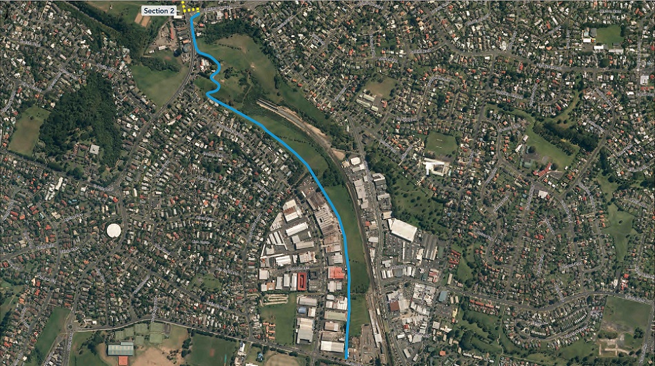
Section 2 - St Johns Road to Ōrākei Basin
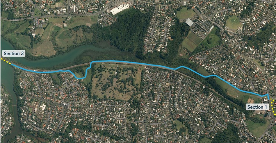
A series of mahi toi (artworks) were unveiled in May 2024 along Section 2 of the path between Kohimarama Road and Ōrākei Basin. This includes 2 sets of pou (cultural markers) at the end of each path acting as waharoa (entranceways), and carved handrails at both ends of the 2 bridges.
All artworks relate to the central design theme ‘Te Ara Ki Uta Ki Tai’ (from the land to the sea). The 4.5m tall green and red waka pou at Ōrākei Basin are named Ki Uta and Ki Tai respectively. They mark the point between sections 2 and 3.
The pou at Kohimarama Road represent the inhabitants of the Pourewa Valley below, specifically the piwakawaka (fantail) and tuna (eel). Designs along the carved handrails show the connectivity of the path sections and te maunga (the mountain) and nga wai (the waters).


Section 3 - Ōrākei Basin boardwalk

For more information on this project
Email: projects@at.govt.nz