Train station maps Train station maps
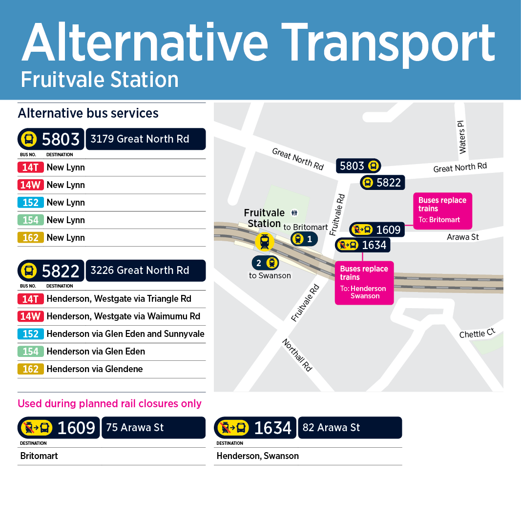
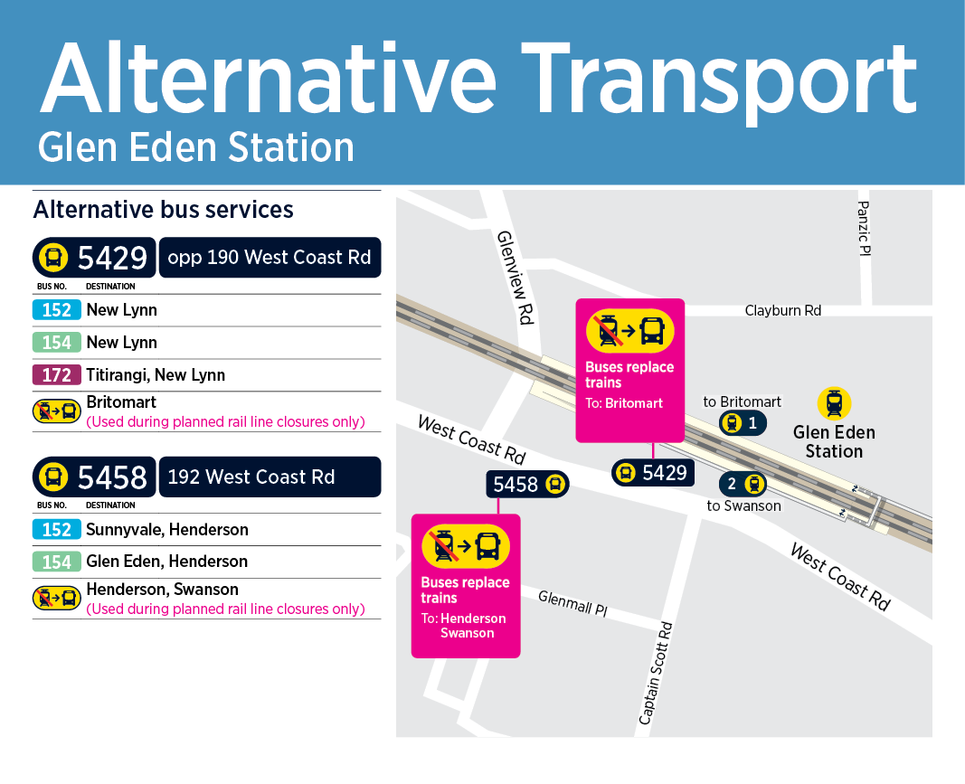
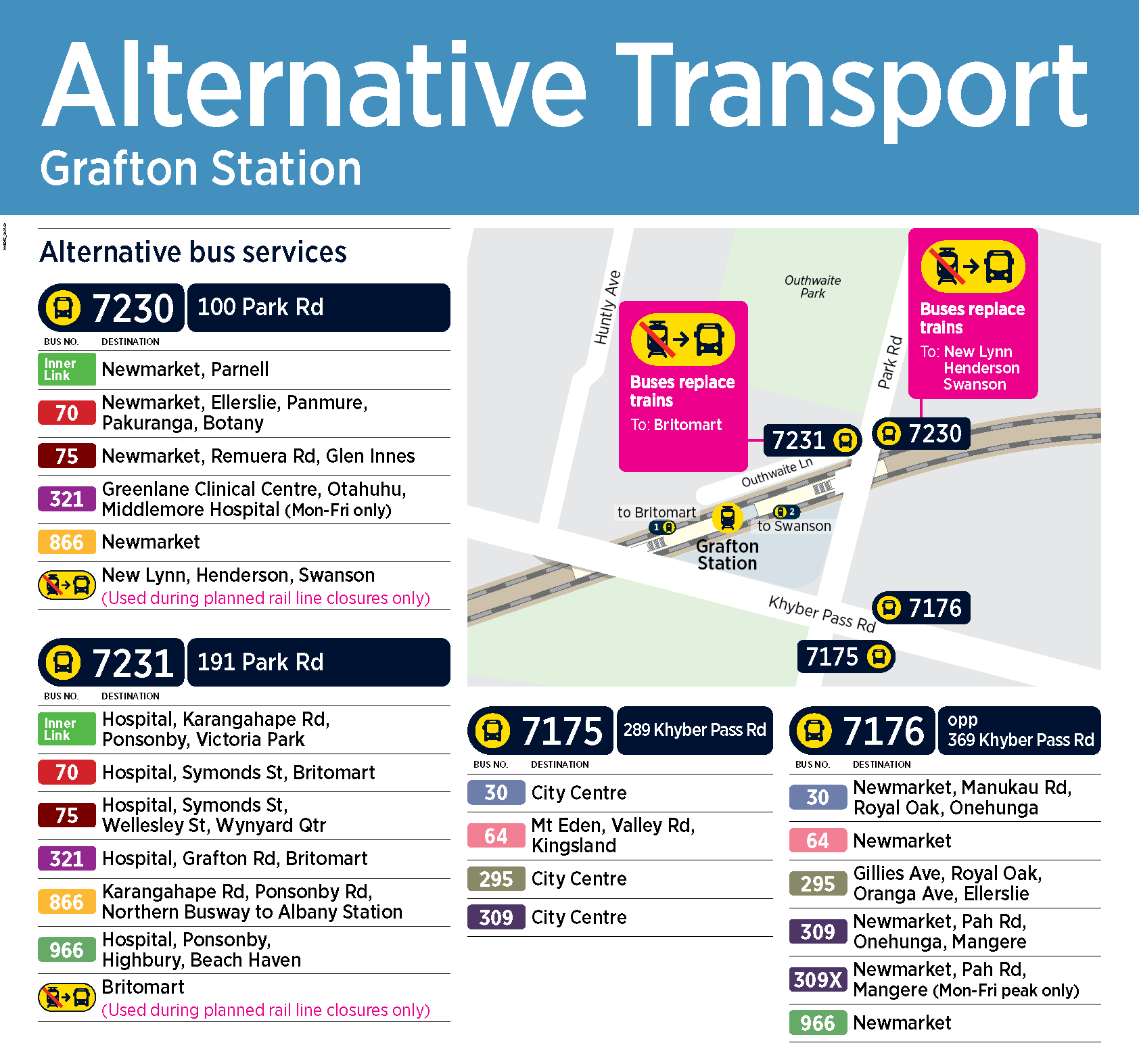
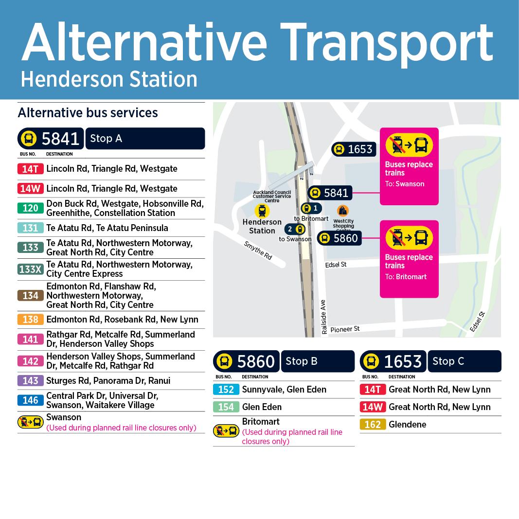
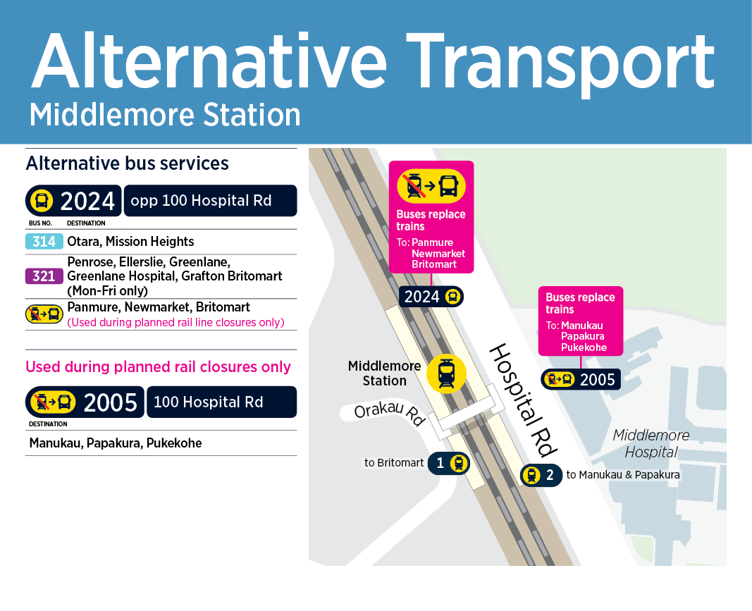
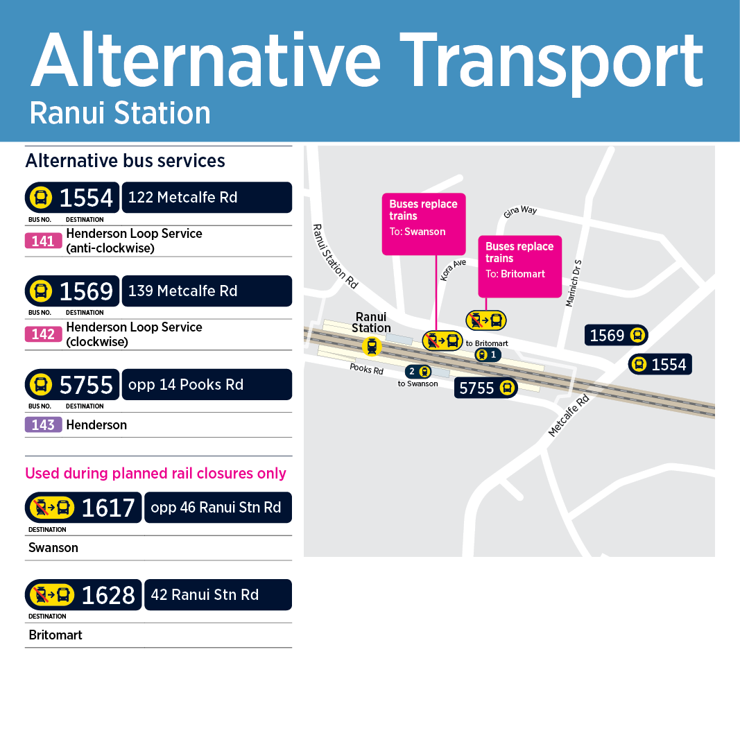
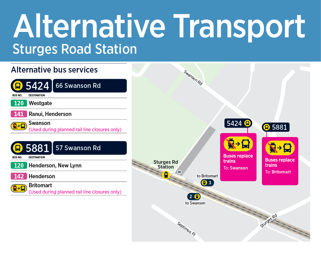
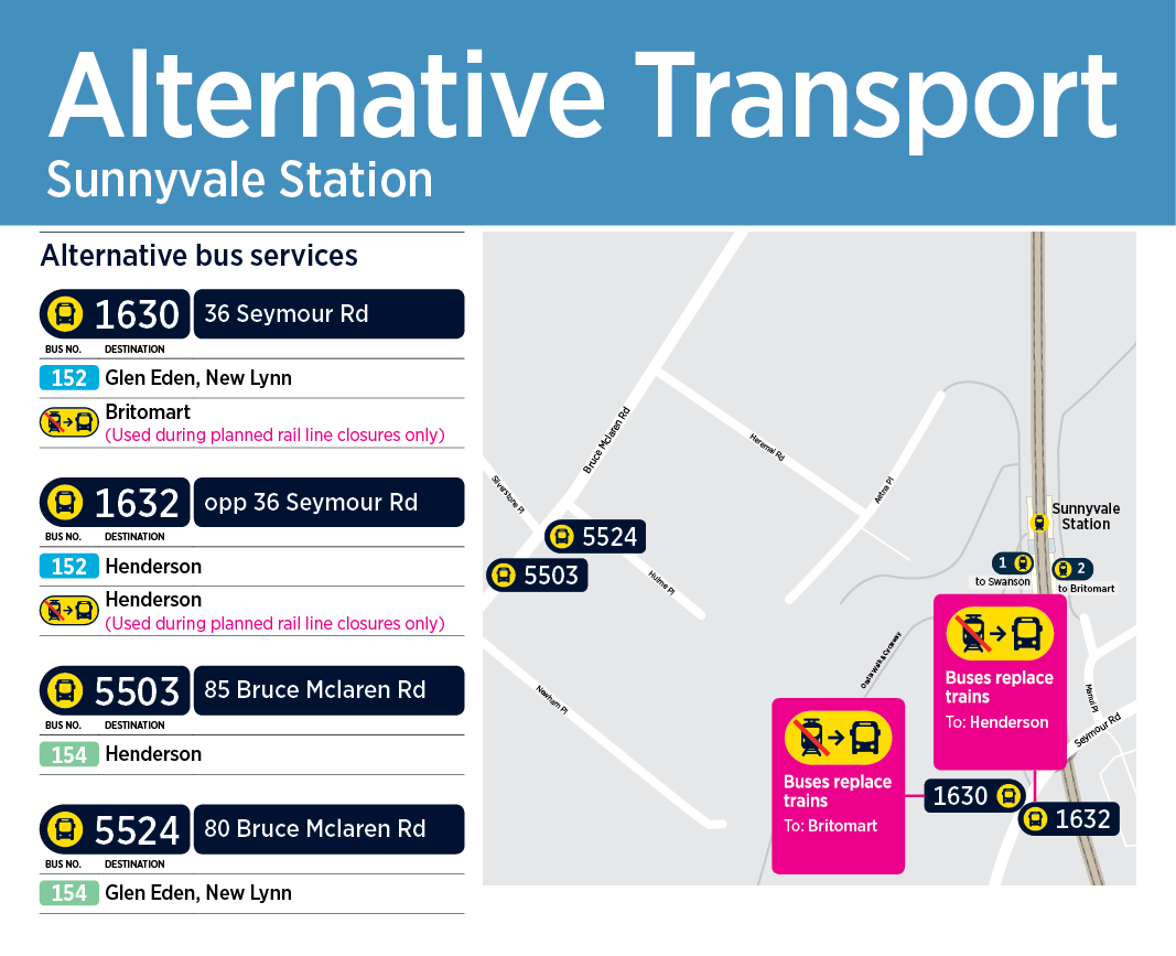
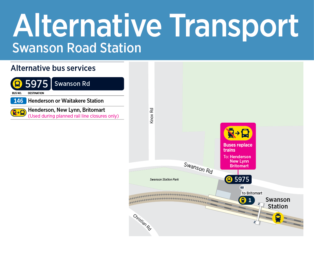
The station maps below show the bus stops near to each station. They show the location of bus stops used by buses replacing trains and scheduled bus services. These may be used when trains are not operating due to upgrade work or service disruptions.
Note: Your paper ticket will be accepted on specified alternative services during a disruption. Please tag off before exiting the station.
- Waitematā Station (Britomart) map (PDF 624KB) - For Waitematā Station replacement bus stop locations. Please check the description at the bottom of the temporary timetables, as replacement bus stop locations at Waitematā Station may vary depending on different closures, such as roadworks or events. For temporary replacement bus timetables, visit Future works on the Auckland rail network
Please note that buses will use the stations shown on this map from 25 December 2021. - Newmarket Station map (PDF 111KB) - For Newmarket replacement bus stop locations. Please check the description at the bottom of the temporary timetables, as replacement bus stop locations at Newmarket may vary depending on different closures, such as roadworks or events. For temporary replacement bus timetables, visit Future works on the Auckland rail network.
Note: Rail Buses are unable to stop at Parnell or Meadowbank stations due to difficulties in buses accessing these stations
Replacement bus stops and alternative transport options
Avondale

Baldwin Ave

Ellerslie

Fruitvale
Glen Eden
Glen Innes

Grafton
Greenlane

Henderson
Homai
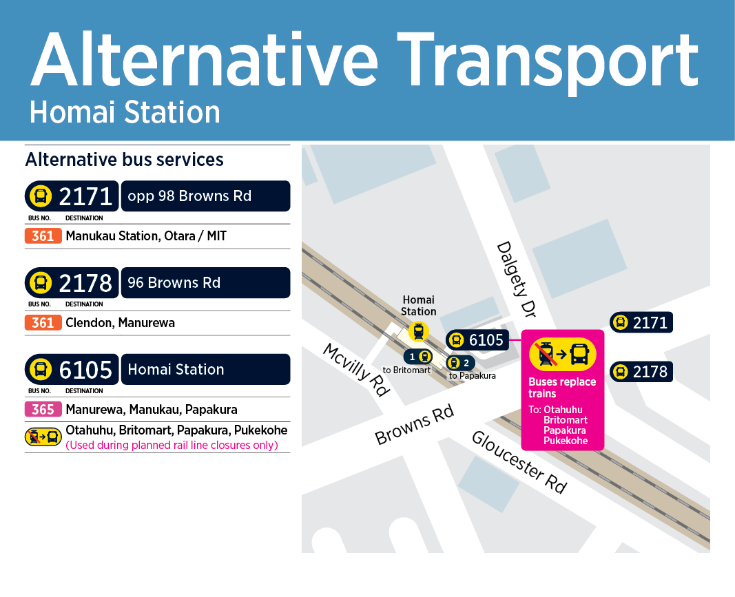
Alternative transport options
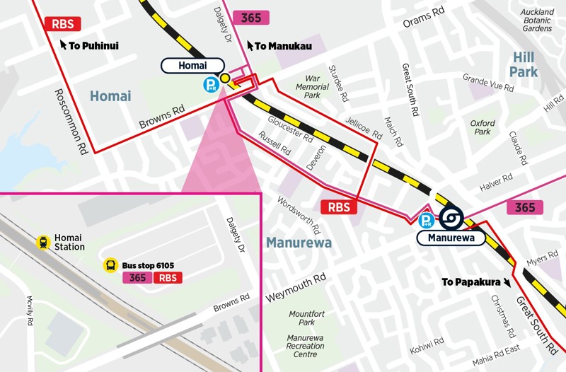
- Bus 365 - Hourly timetable between Papakura Interchange and Manukau Bus Station via Porchester Road
- Rail replacement bus (RBS) stopping at all stations between Papakura and Puhinui
Kingsland

Manukau

Alternative transport options
- Bus 33 - High frequency option between Papakura Interchange and Ōtāhuhu Station via Great South Road.
- Bus 365 - Hourly timetable between Papakura Interchange and Manukau Bus Station via Porchester Road
- Airport Link via Puhinui Station

Manurewa
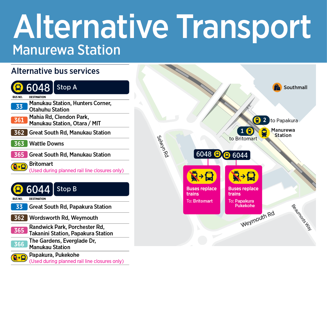
Alternative transport options
- Bus 33 - High frequency option between Papakura Interchange and Ōtāhuhu Station via Great South Road.
- Bus 365 - Hourly timetable between Papakura Interchange and Manukau Bus Station via Porchester Road
- Rail replacement bus (RBS) stopping at all stations between Papakura and Puhinui

Meadowbank

Middlemore
Morningside

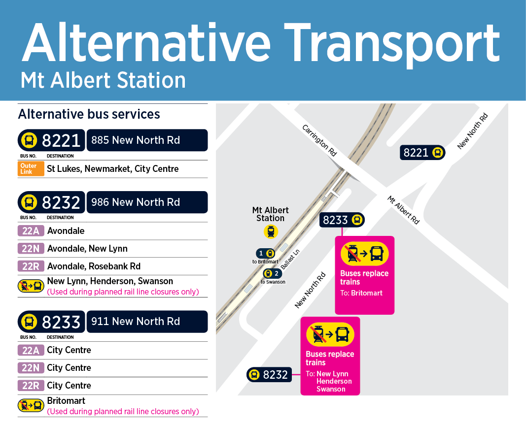
Mt Albert
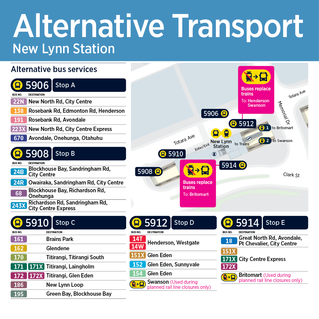
New Lynn
Onehunga

Ōrākei

Otahuhu

Panmure

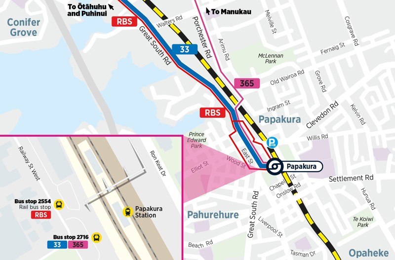
Papakura

Alternative transport options
- Bus 33 - High frequency option between Papakura Interchange and Ōtāhuhu Station via Great South Road.
- Bus 365 - Hourly timetable between Papakura Interchange and Manukau Bus Station via Porchester Road.
- Rail replacement bus (RBS) stopping at all stations between Papakura and Puhinui.
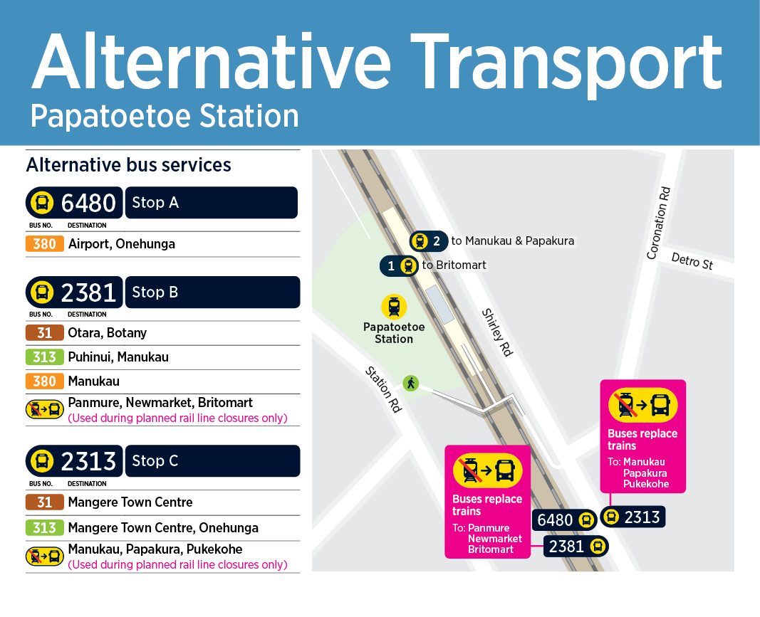
Papatoetoe
Penrose

Puhinui

Alternative transport options
- Rail replace bus (RBS) stopping at all stations between Papakura and Puhinui.
- Airport Link via Puhinui Station.

Pukekohe

Ranui
Remuera

Sturges Road
Sunnyvale
Swanson
Sylvia Park

Takanini
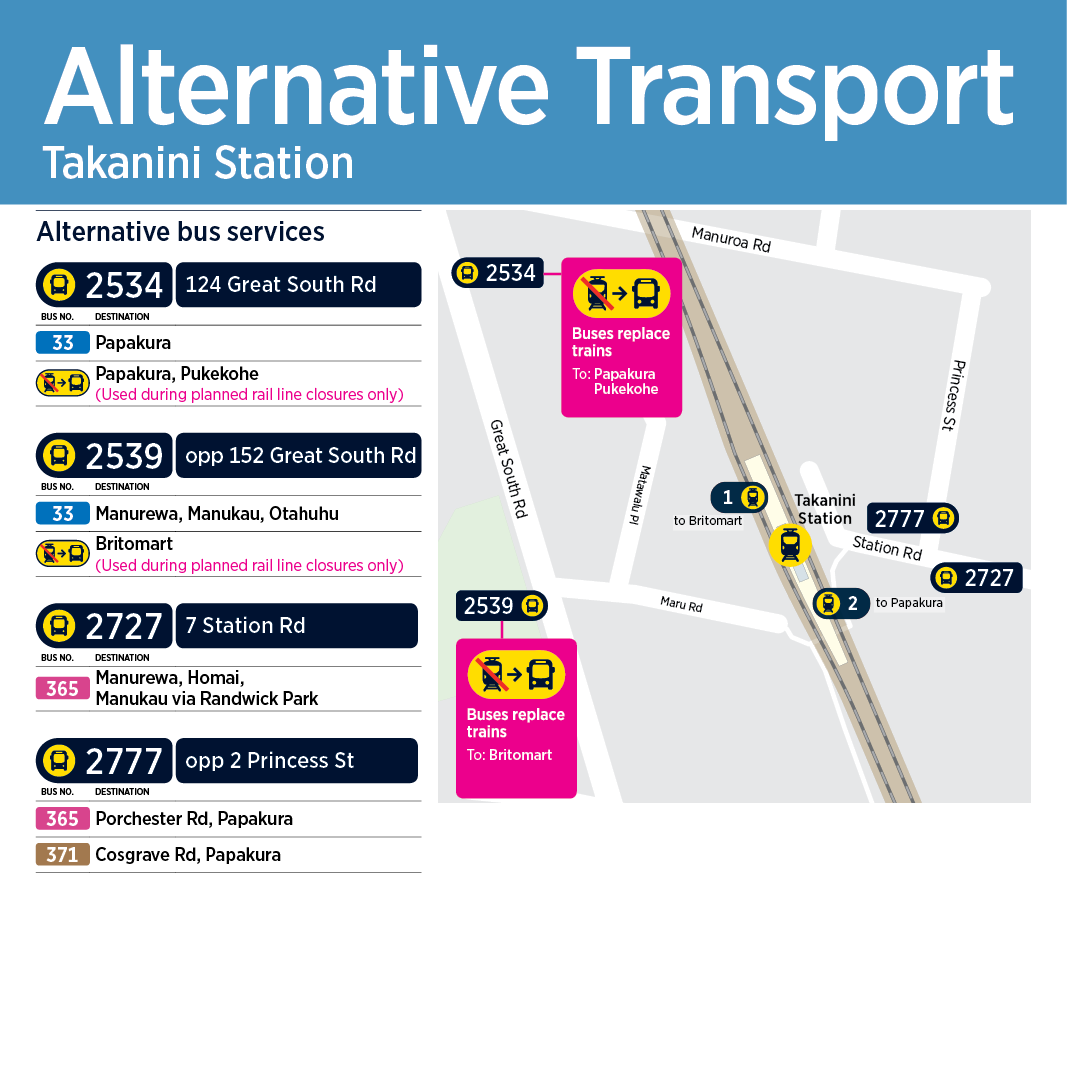
Alternative transport options
- Bus 33 - High frequency option between Papakura Interchange and Ōtāhuhu Station via Great South Road.
- Bus 365 - Hourly timetable between Papakura Interchange and Manukau Bus Station via Porchester Road.
- Rail replacement bus (RBS) stopping at all stations between Papakura and Puhinui.

Te Mahia

Alternative transport options
- Bus 33 - High frequency option between Papakura Interchange and Ōtāhuhu Station via Great South Road.
- Bus 65 - Hourly timetable between Papakura Interchange and Manukau Bus Station via Porchester Road.
- Rail replacement bus (RBS) stopping at all stations between Papakura and Puhinui.

Te Papapa
